UNVEILING INNOVATIONS THAT SHAPE THE FUTURE OF WATER MANAGEMENT IN EASTERN NEBRASKA
Projects
Explore datasets, hydrogeologic interpretations and reports for effective water management in Eastern Nebraska
ENWRA’s project listings showcase a dynamic range of initiatives, from pioneering geologic frameworks to cutting-edge interpretations for understanding groundwater-surface water interactions and water budgets. These endeavors, meticulously crafted by collaborating with key partners and employing innovative technologies, represent our commitment to navigating the complex hydrogeologic landscapes of Eastern Nebraska. Dive into the details of each project, uncovering a transformative picture of the subsurface laying the groundwork for a resilient and sustainable water future for the region.
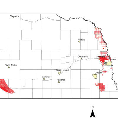
2025 Airborne Electromagnetic (AEM) Surveys
AEM Report AEM surveys were flown in the Lower Big Blue NRD in the summer of 2025 with awarded Water Sustainability Fund (WSF) grant dollars. The 2025 AEM Report is anticipated in spring 2026.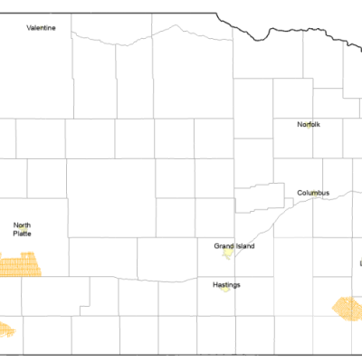
2024 Airborne Electromagnetic (AEM) Surveys
AEM Report AEM surveys were flown in Nebraska in the summer of 2024. The Lower Big Blue NRD and Middle Republican NRD were awarded Water Sustainability Fund (WSF) grant dollars for the 2024 AEM Surveys. The resulting datasets from each of the NRD surveys will be uploaded to the Nebraska GeoCloud (NGC): https://snr.unl.edu/csd/geology/AEM.aspx. The NGC is a web-based digital platform for geophysical, geological, and groundwater data and models. The purpose of the NGC is to archive Nebraska’s vast volume of data and make it accessible to both model builders and model users.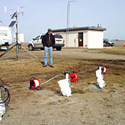
Water Quantity Monitoring
Pilot Sites & Wells Aquifer test at Logan East Rural Water System. Aquifer tests were performed at the Oakland pilot site in Lower Elkhorn NRD and the Firth pilot site in Lower Platte South NRD near Hickman to assess the aquifer extent, amount of water in storage, the rate of water movement, and its potential hydraulic connection to other aquifers.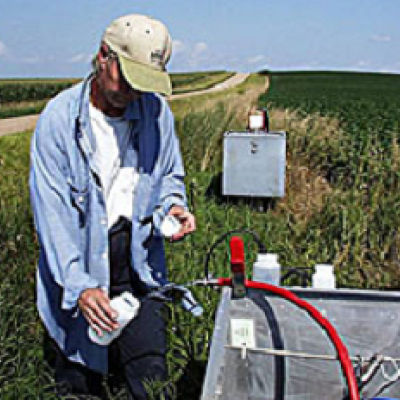
Water Quality Monitoring
Pilot Sites & Wells Collecting a water quality sample at Oakland Pilot Site in the Lower Elkhorn NRD. ENWRA has approximately 78 wells across the Ashland, Firth and Oakland pilot study sites that have been sampled annually, compiled in tables and graphed for water quality trends since 2007.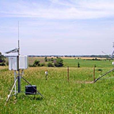
ENWRA Recharge
Recharge Vadose zone equipment and weather station at ENWRA's Firth Pilot Study Site. ENWRA uses heat-dissipation sensors, soil moisture probes, and weather stations (air and soil temperature, precipitation, humidity, wind speed, solar radiation, and potential evapotranspiration) to continuously collect data regarding groundwater recharge at each of the pilot study sites. This information contributes to understanding the volume of precipitation recharging the underlying aquifer at a specific site, how fast that recharge occurs, and the importance of vertical and horizontal flow paths.
ENWRA Archive
ENWRA Archive Conservation and Survey Division (CSD), School of Natural Resources at University of Nebraska-Lincoln archived geological files available in PDF format for the ENWRA area of Nebraska. Historical paper files housed at CSD were scanned and organized by county for over 5,000 sets of records plus over 1,000 oversized PDFs and cross-sections for 26 eastern Nebraska counties.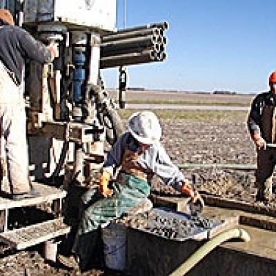
Test Hole Drilling
Pilot Sites & Wells Test holes are drilled to obtain geoscientific data of the substrata, groundwater, and natural resources underlying Nebraska. The CSD Drilling Program drills an average of over 10,000 feet annually and has drilled nearly 6,000 test holes throughout the state since 1930. Geological material from these test holes is preserved at the University of Nebraska, School of Natural Resources, Conservation and Survey Division's Geological Sample Repository.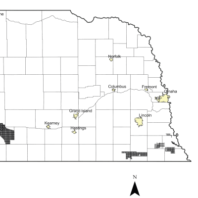
2023 Airborne Electromagnetic (AEM) Surveys
AEM Report Several 2023 AEM surveys were flown by the Nebraska NRDs in the summer of 2023. The Nemaha NRD and neighboring Lower Big Blue NRD were awarded Water Sustainability Fund (WSF) grant dollars for the upcoming 2023 surveys as well as the Middle Republican NRD. The resulting datasets from each of the NRD surveys will be uploaded to the Nebraska GeoCloud (NGC): https://snr.unl.edu/csd/geology/AEM.aspx. The NGC is a web-based digital platform for geophysical, geological, and groundwater data and models. The purpose of the NGC is to archive Nebraska’s vast volume of data and make it accessible to both model builders and model users.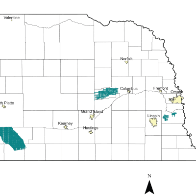
2022 Airborne Electromagnetic (AEM) Surveys
AEM Report The Lower Loup and Middle Republican Nebraska Natural Resources Districts (NRDs) conducted AEM flights in Summer 2022 using Water Sustainability Fund (WSF) grant dollars awarded in 2021. In eastern Nebraska, a private entity in the Lower Platte South NRD also conducted an AEM reconnaissance survey in Cass County Nebraska in 2022 as a follow-up to the previous 2020 AEM Cass County survey.