2024 Airborne Electromagnetic (AEM) Surveys
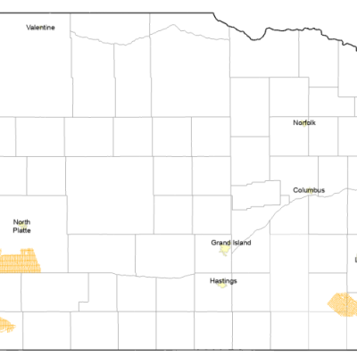
Several Airborne Electromagnetic (AEM) surveys were flown by the Nebraska NRDs in the summer of 2024. The Lower Big Blue NRD was awarded Water Sustainability Fund (WSF) grant dollars for the 2024 AEM survey work, continuing their phased approach to cover the entire District. The Middle Republican NRD also conducted AEM flights in 2024 continuing their survey plans over multiple years with WSF grant dollars. The resulting datasets from each of the NRD surveys will be uploaded to the Nebraska GeoCloud (NGC): go.unl.edu/aem.
Digital versions of Flight Lines are available here: ESRI Geodatabase File Download (zip file 3.3 MB) kmz file Download (Google Earth file 6.3 MB)
Video AEM overview (depreciated, new video coming soon)
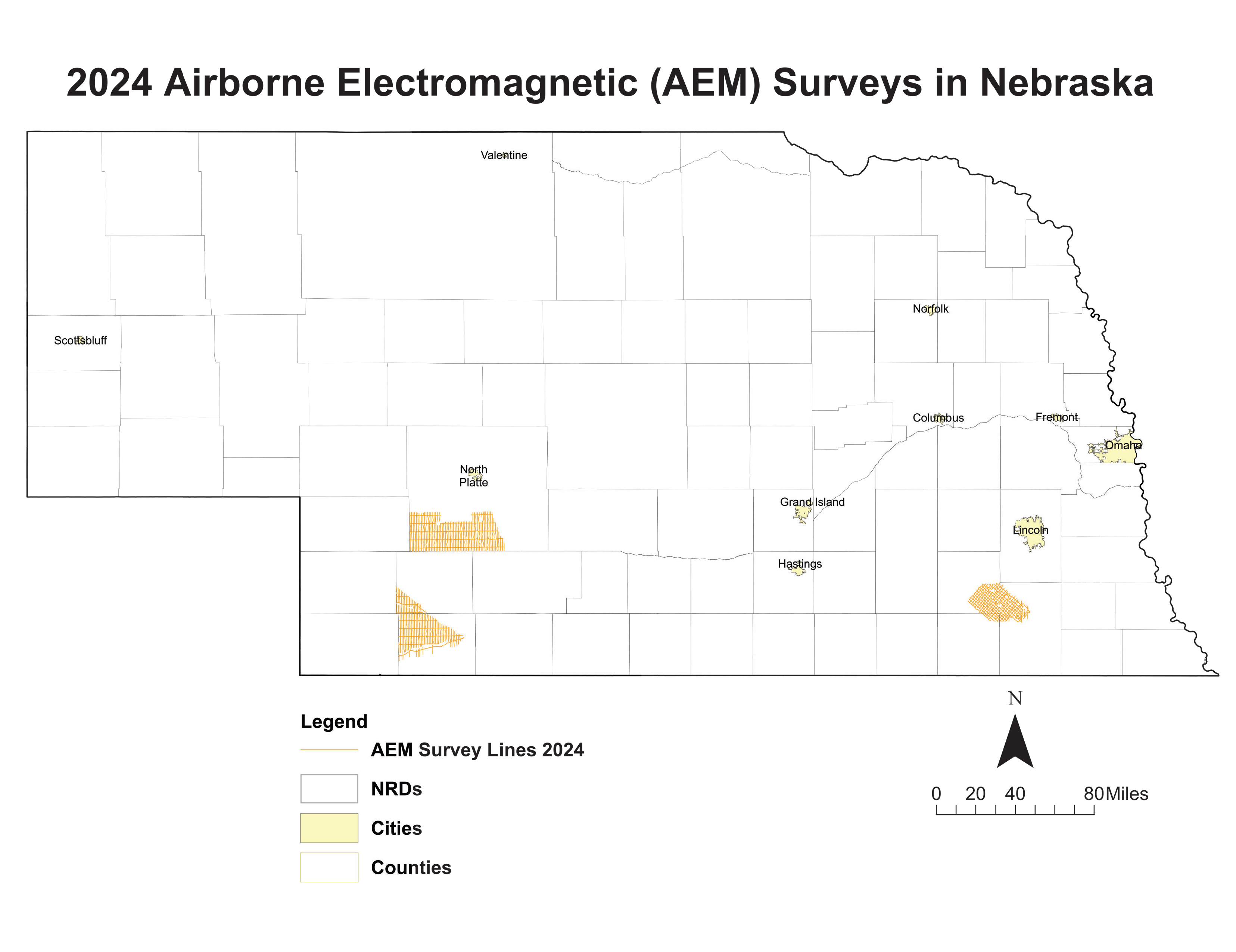
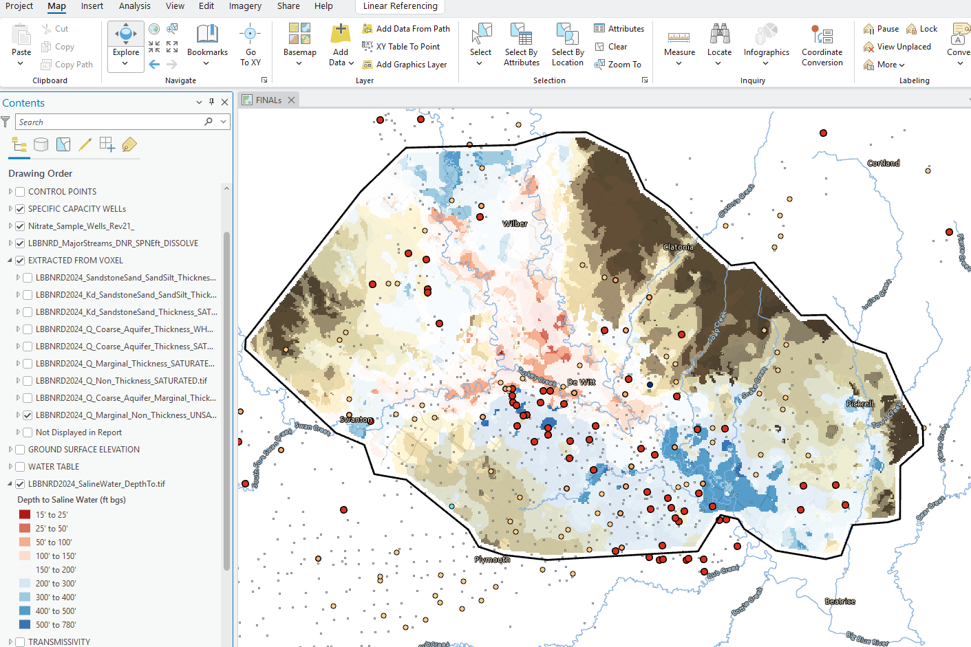
Approximately 536 line-miles of AEM survey were acquired with the SkyTEM 304 system for the Lower Big Blue AEM survey in June and July 2024. Collected data was processed in the Spatially Constrained Inversion (SCI) AEM earth models with 39 layers. Mapping results produced from the AEM data for the LBBNRD project provide three-dimensional subsurface views of the aquifer materials and estimates of the extents of the groundwater resources available following the approach used for previous Eastern Nebraska Water Resources Assessment (ENWRA) areas. Interpretations provided in the 2024 AEM Report, including the identification of potential saline groundwater locations, will be used by the NRD to address potential quantity and quality concerns in the Lower Big Blue NRD.
Find Your Area of Interest
Lower Big Blue NRD 2024 AEM Survey
Links
ESRI Datasets:
Google Earth Datasets:
The interpreted results for the 2024 AEM flights have been provided in Google Earth format. You can download the free version of Google Earth Pro by clicking here.
*Click here for a link to download the Google Earth datasets from ENWRA's Dropbox.
The link above provides a link to the KMZ Folder deliverable with ".kmz" files that will show the 2024 AEM flight line locations: "as flown" and "retained" where data was chopped out from interferences (Flight Lines Folder), as well as interpreted ".kmz" files that show clickable data dots in Google Earth (LBBNRD24_Profiles Folder) for the Lower Big Blue NRD: LBBNRD2024_Interpretation_KMZ.kmz. There are 60 associated image files (117 MB) linked to the data dots provided in the interpreted .kmz file.
You do not have to sign-up for a Dropbox account to download the files (sometimes written in fine print at the bottom of a log in or sign up button or depicted as a down arrow symbol). You must have Google Earth installed on your computer before opening the .kmz Google Earth dataset files. If you already have a Dropbox account, please sign out before clicking this link and choose download so you do not fill up space on your personal Dropbox.
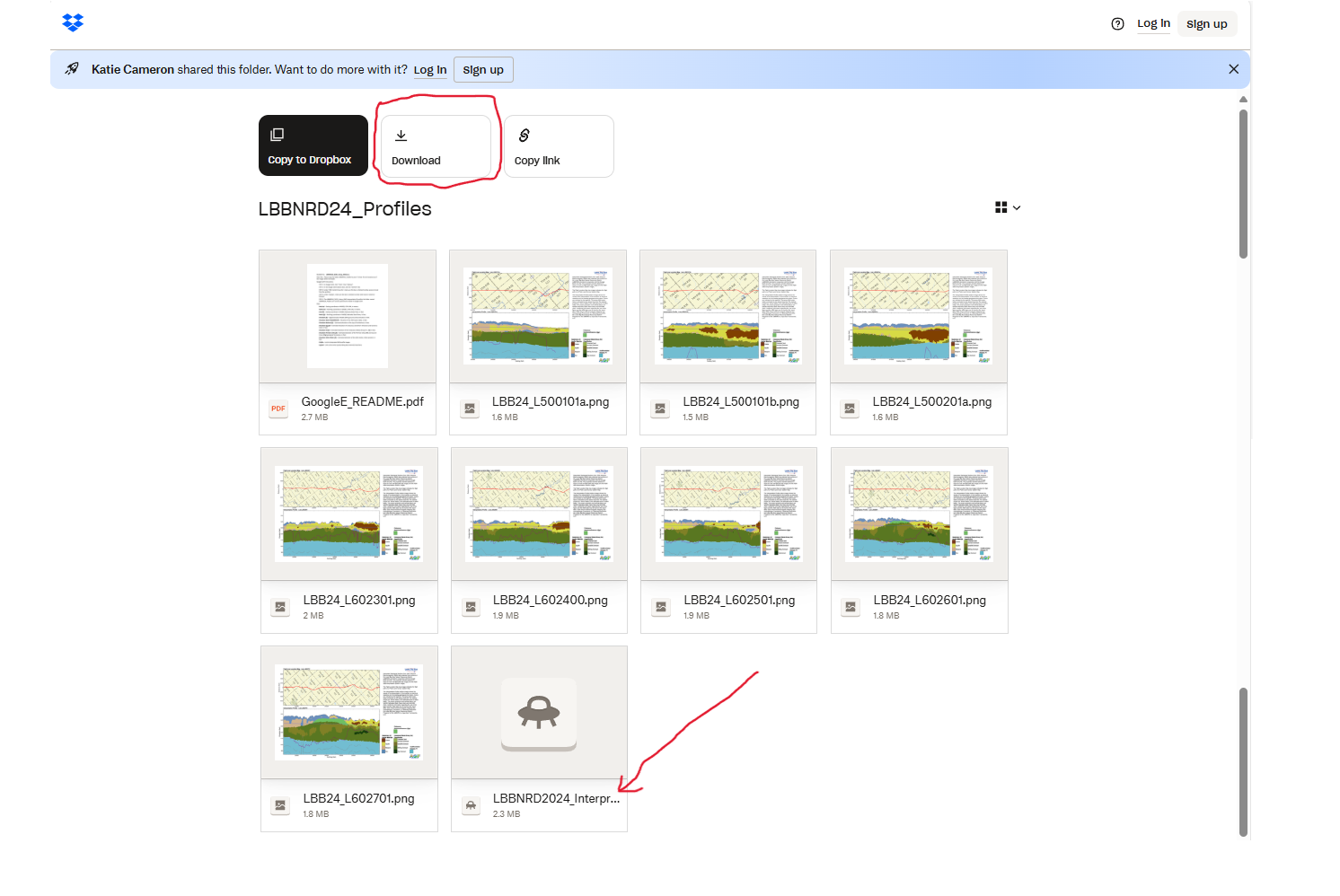
Please follow the instructions in the "GoogleE_README.pdf" PDF file on Dropbox here and save the downloaded files with the same exact file structure as shown on the Dropbox onto your computer's C drive. See the video tutorial example here for detailed walkthrough. Google Earth will look here on your hard drive: C:\LBBNRD24_Profiles for every profile image when you touch a link on a data dot - see example image below.
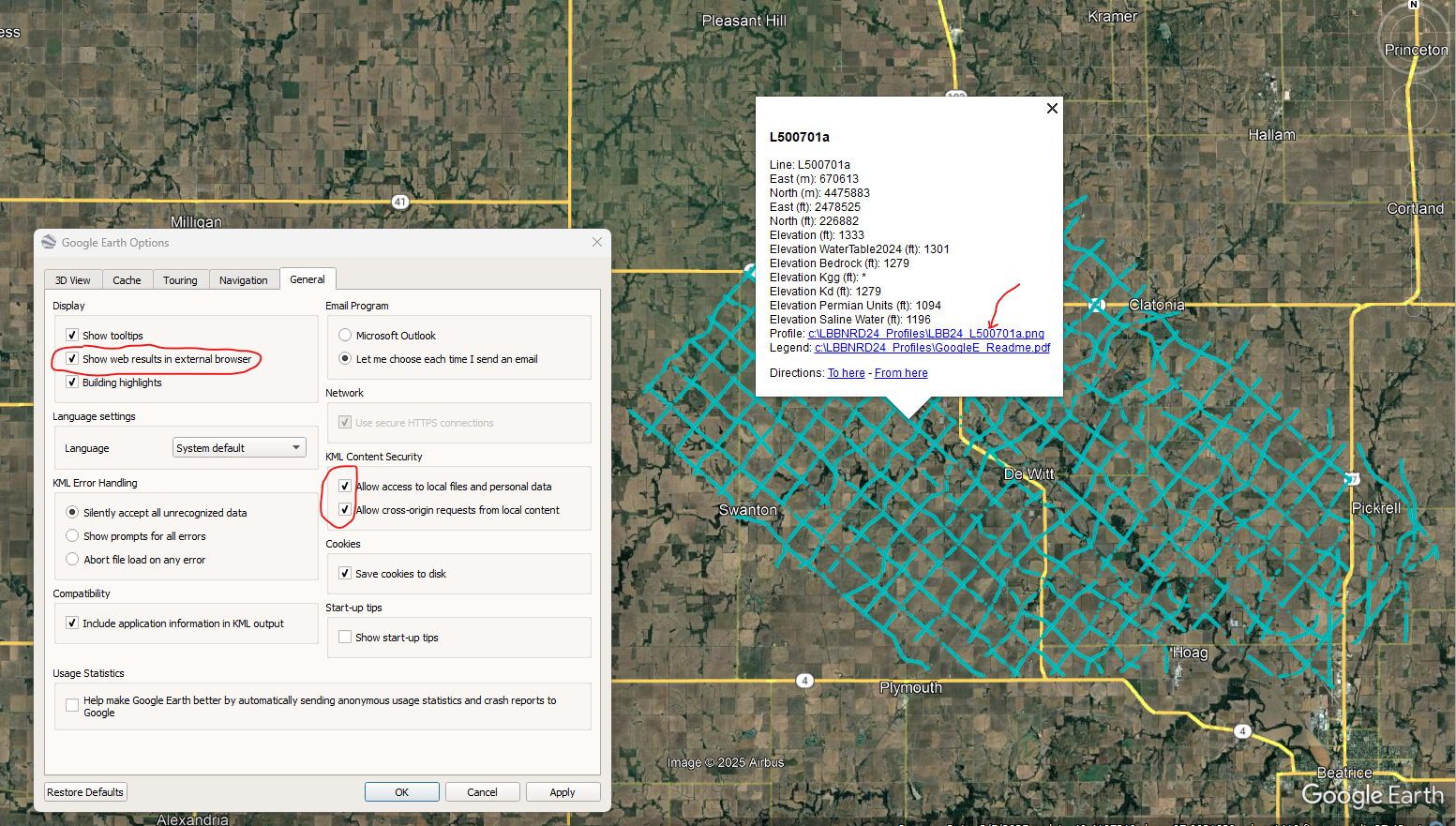
NOTE: You can view flight lines from some mobile devices if you have Google Earth but you need to use a Microsoft Windows computer to see the data and hot linked profile images. It is recommended to zoom into a road intersection first so the larger .kmz files don't take too long to load on-screen.