2020 Airborne Electromagnetic (AEM) Surveys
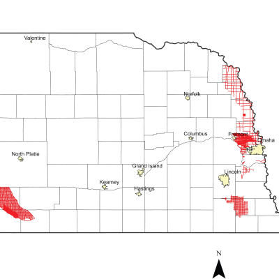
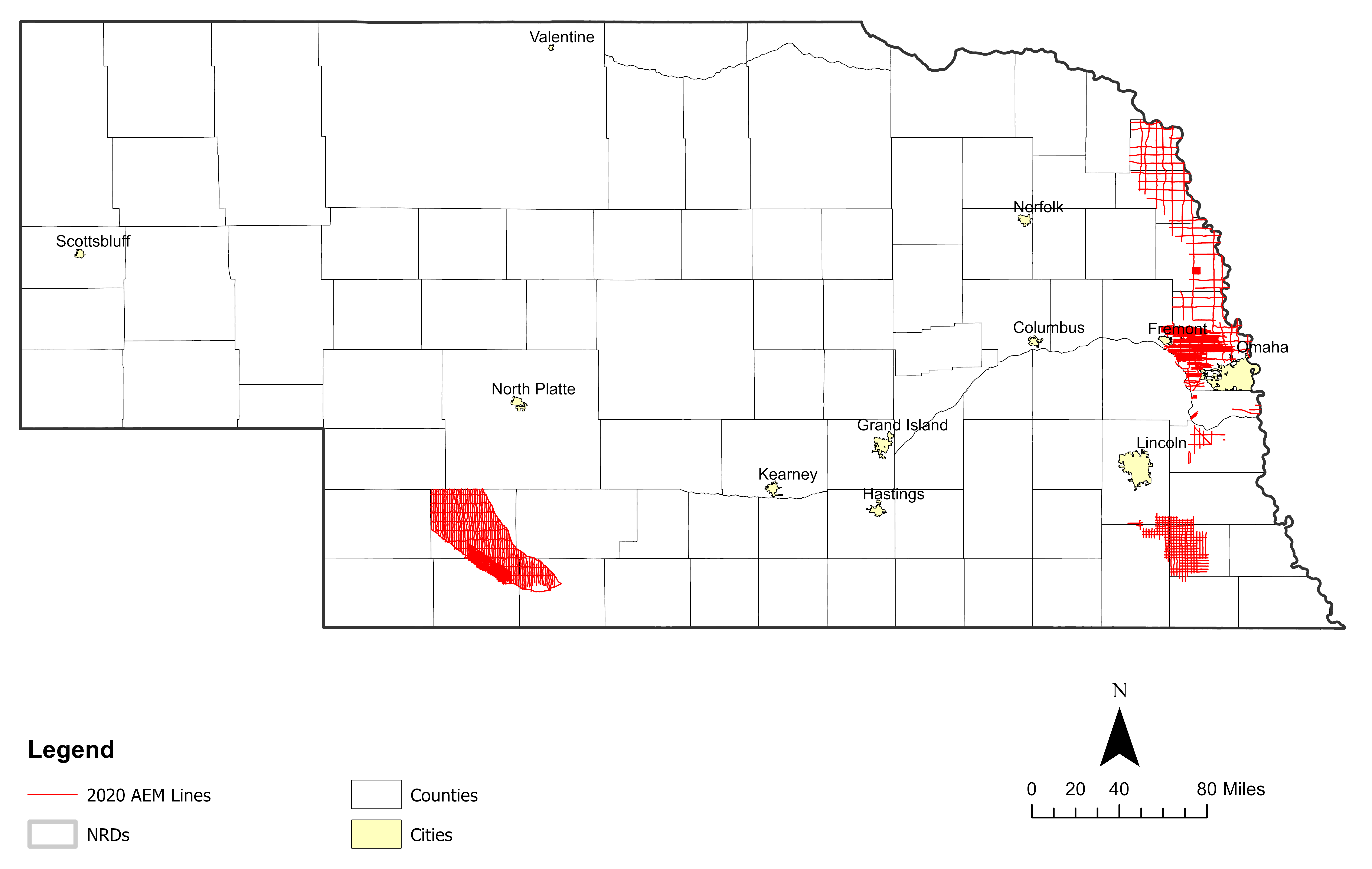
The Nemaha and Papio-Missouri River NRDs conducted AEM flights in eastern Nebraska in August 2020 and 62 line-miles were also flown over Cass County Nebraska by a private entity in the Lower Platte South NRD. The Nemaha flew approximately 560 line-miles of AEM survey extending out the one mile grid coverage flown in 2018 westward. The Papio-Missouri River NRD acquired 1,533 line-miles of reconnaissance and block surveys (Tekamah area and Washington and Douglas Counties). Both NRDs received 2020 AEM report deliverables from AGF with merged datasets incorporating previous 2014/2015 ENWRA reconnaissance and 2018 AEM surveys (Papio-Missouri River NRD also received ENWRA's historical 2006 Ashland pilot site data redelivered in a format compatible with the Nebraska GeoCloud). Key findings included: new understandings from borehole and AEM comparisons, improved surface grids for geologic contacts, more advanced sediment character and resistivity threshold evaluations, improved framework and recharge understandings, and data integration methods for combining newer and older survey datasets.
Find Your Area of Interest
Cass County 2020 AEM Survey
Links
Name: CassCounty_2020_AEM_SCI_INV
Description: AGF reconnaissance survey in Cass Co., 62 line-miles - AGF, J. Abraham, Aarhus Workbench v. 6.3.1.0
Type: SkyTEM 304M Resistivity-depth, spatially constrained inversion (SCI)
EPSG: NAD 83 State Plane meters 32104 & feet 26852
Nemaha NRD 2020 AEM Survey (see 2023 AEM for updated 2020 data)
Links
Google Earth Datasets:
The interpreted results for the 2020 AEM flights have been provided in Google Earth format. You can download the free version of Google Earth Pro by clicking here.
*Click here for a link to download the Google Earth datasets from ENWRA's Dropbox.
The link above provides ".kmz" files that will show the 2020 AEM flight line locations "as flown" and where data was chopped out from interferences ("retained") as well as interpreted ".kmz" files that show attributed data dots in Google Earth you can click on (NNRD20_Interpretation_KMZ_v3.kmz). There are 78 associated image files (56 MB) linked to the data dots provided in the interpreted .kmz file.
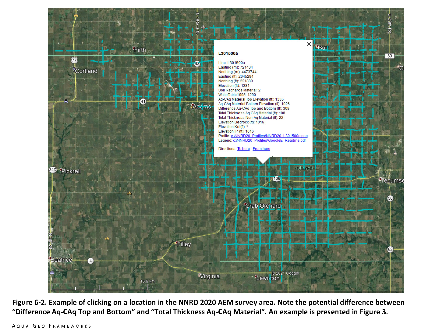
Please follow the instructions in the "GoogleE_README.pdf" PDF file on Dropbox here AND save the downloaded files with the same exact file structure as shown on the Dropbox onto your computer's C drive. See the video tutorials here for detailed instructions. Google Earth will look here on your hard drive: C:\NNRD20_Profiles for every profile image when you touch a link on a data dot - see example image below. An easy way is to do this is to select download from the Dropbox link and then go unzip the Dropbox file wherever your browser typically puts downloaded files (right click and hit extract). Once the folder has been unzipped then cut, copy or drag the unzipped file folder called "NNRD20_Profiles" directly onto your C drive.
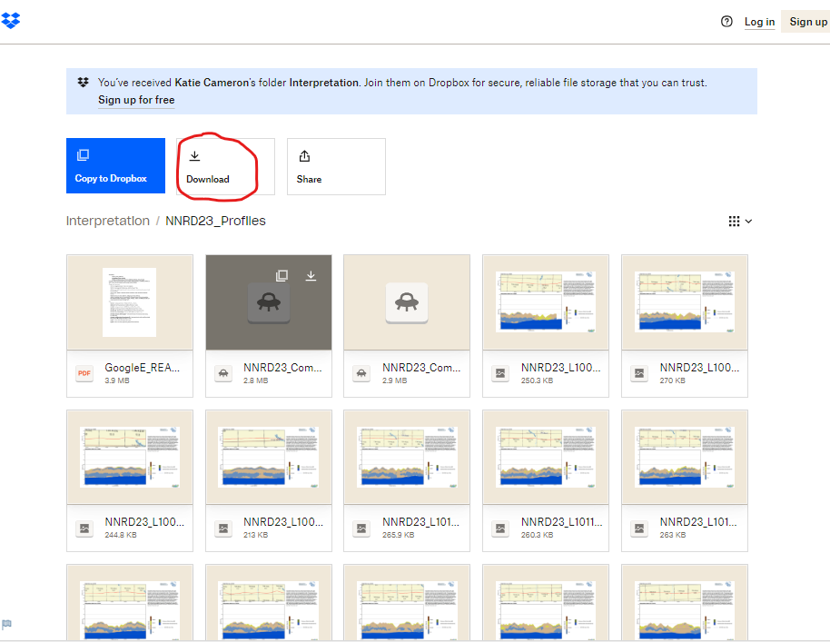
You must have Google Earth installed on your computer before downloading or opening the .kmz Google Earth dataset files. If you already have a Dropbox account, please choose download so you do not fill up space on your personal Dropbox (image below from 2023 AEM kmz folder which contains redelivered image files for the 2020 AEM Lines).
 NOTE: You can view flight lines from some mobile devices if you have Google Earth but you need to use a Microsoft Windows computer to see the data and hot linked profile images.
Papio-Missouri River NRD 2020 AEM Survey (includes 2006 Ashland Redelivered)
Links
Google Earth Datasets:
The interpreted results for the 2020 AEM flights have been provided in Google Earth format. You can download the free version of Google Earth Pro by clicking here.
*Click here for a link to download the Google Earth datasets from ENWRA's Dropbox.
The link above provides ".kmz" files that will show the 2020 AEM flight lines "as flown" and where data was chopped out from interferences ("retained") as well as ".kmz" files that show attributed data dots in Google Earth you can click on. The attributed ".kmz" files are broken into 8 parts for the grid-style and block area lines flown across the District. There are 445 associated image files (335 MB) linked to the data dots provided in the 8 area ".kmz" files.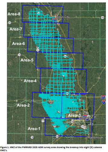
You do not need to sign-up for a Dropbox account to download the files (download button can be hard to spot). You must have Google Earth installed on your computer before downloading or opening the .kmz Google Earth dataset files. If you already have a Dropbox account, please choose download so you do not fill up space on your personal Dropbox.
Please follow the instructions in the "GoogleE_README.pdf" PDF file on Dropbox here AND save the downloaded files with the same exact file structure as shown on the Dropbox onto your computer's C drive.
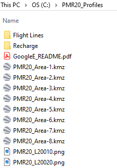
See the video tutorials here for detailed instructions. Google Earth will look here on your hard drive: C:\PMR20_Profiles for every profile image when you touch a link on a data dot - see example image below. An easy way is to do this is to select direct download at the upper right from the Dropbox link and then go unzip the Dropbox file wherever your browser typically puts downloaded files (right click and hit extract). Once the folder has been unzipped then cut, copy or drag the unzipped file folder called "PMR20_Profiles" directly onto your C drive.
NOTE: You can view flight lines from some mobile devices if you have Google Earth but you need to use a Microsoft Windows computer to see the data and hot linked profile images.