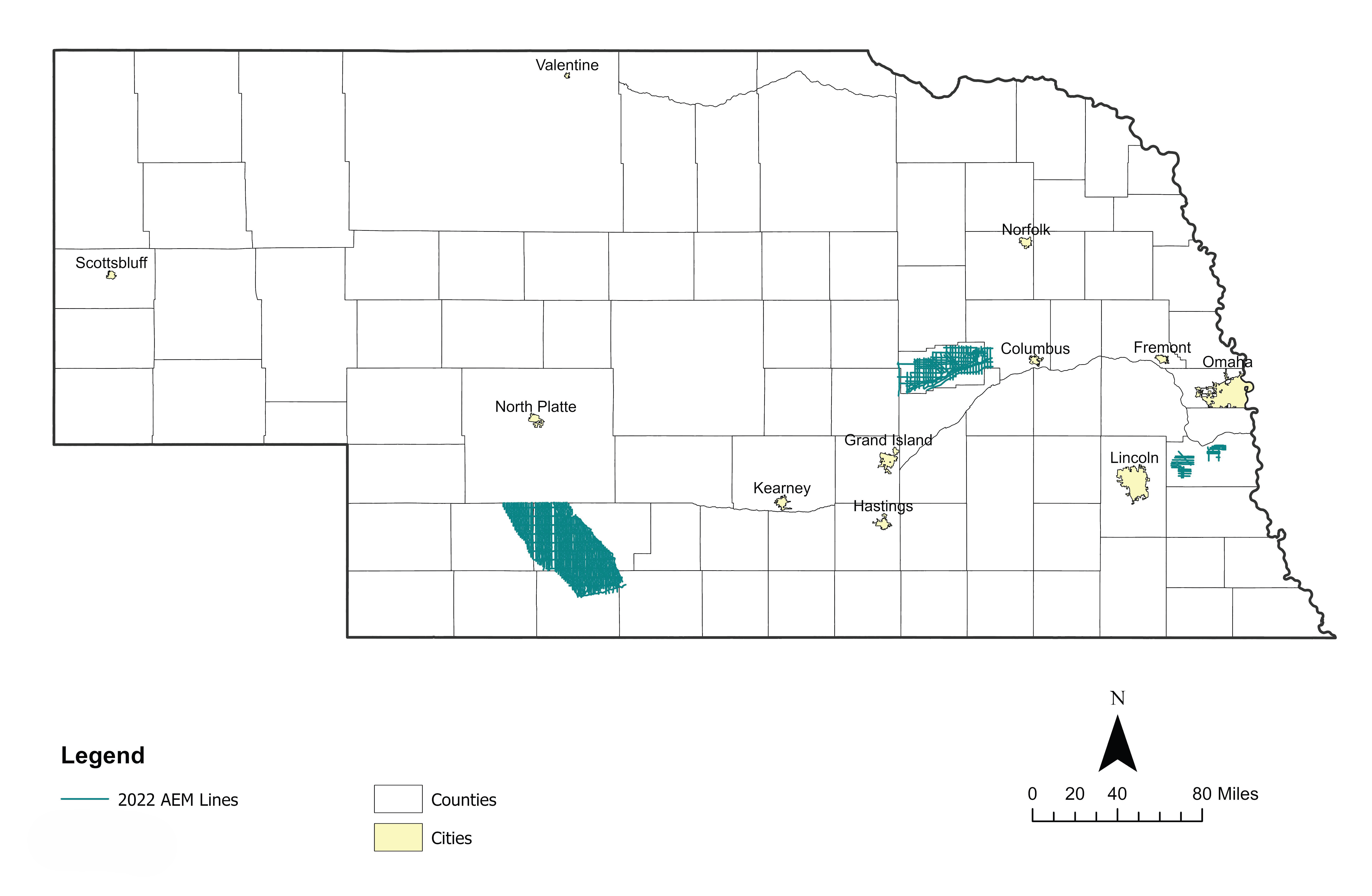
2022 Airborne Electromagnetic (AEM) Surveys
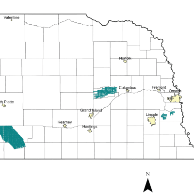
The Lower Loup and Middle Republican Nebraska Natural Resources Districts (NRDs) conducted AEM flights in Summer 2022 using Water Sustainability Fund (WSF) grant dollars awarded in 2021. In eastern Nebraska, a private entity in the Lower Platte South NRD also conducted an AEM reconnaissance survey in Cass County Nebraska in 2022 as a follow-up to the previous 2020 AEM Cass County survey.
Approximately 133 line-miles of AEM survey were acquired with the SkyTEM 304-HR75 system for the Cass County 2022 AEM survey. Collected data was processed in the Spatially Constrained Inversion (SCI) AEM earth models with 39 layers. In addition to covering a larger area, the 2022 survey lines were tighter in pattern as compared to the 2020 Cass County AEM survey lines conducted with the SkyTEM304M system.
Find Your Area of Interest
Cass County 2022 AEM Survey
Links
Name: CassCounty_2022_AEM_SCI_INV
Description: AGF reconnaissance survey in Cass Co., 133 line-miles - AGF, J. Abraham, Aarhus Workbench v. 6.7.0.0
Type: SkyTEM304-HR75 (304-HR75). Resistivity-depth, spatially constrained inversion (SCI)
EPSG: NAD 83 State Plane meters 32104 & feet 26852
KMZ: 2020 and 2022 AEM Survey Flight Path Lines for Cass County:
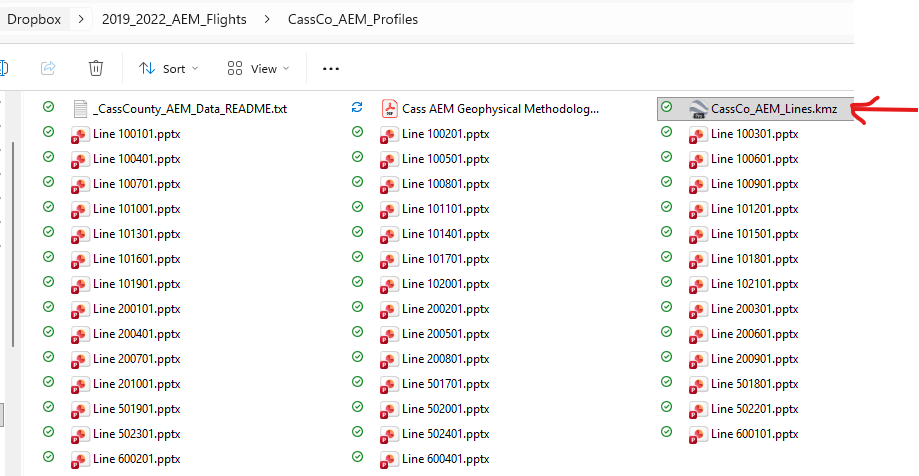
Click here for a ReadMe file describing the data views.