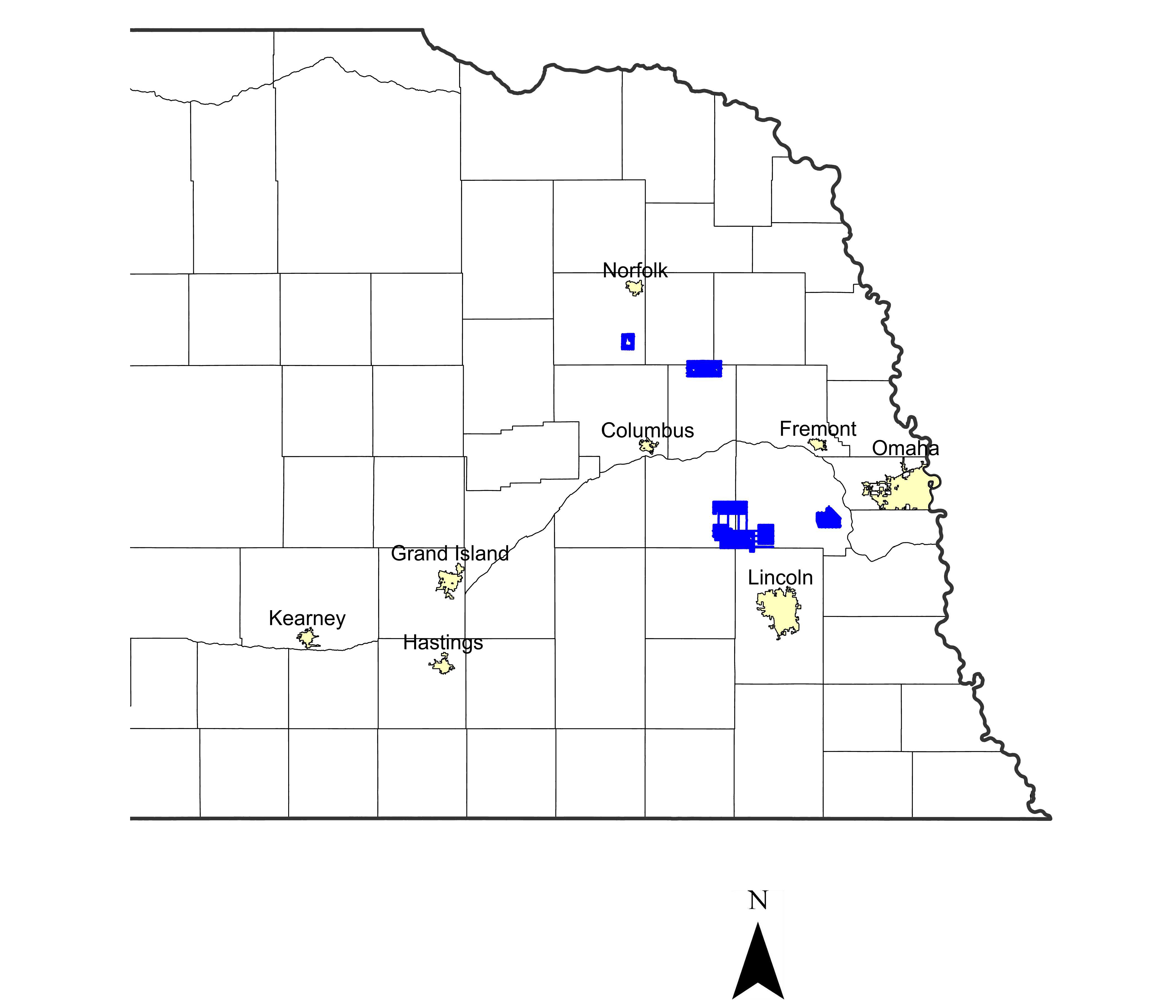
2022 Airborne Electromagnetic (AEM) Surveys

The Lower Loup and Middle Republican Nebraska Natural Resources Districts (NRDs) conducted AEM flights in Summer 2022 using Water Sustainability Fund (WSF) grant dollars awarded in 2021. In eastern Nebraska, a private entity in the Lower Platte South NRD also conducted an AEM reconnaissance survey in Cass County Nebraska in 2022 as a follow-up to the previous 2020 AEM Cass County survey.

2014/2015 ENWRA Reconnaissance Surveys

ENWRA's Reconnaissance AEM Survey effort was broken into two phases: approximately 750 line-miles in the north part of eastern Nebraska flown in October 2014 and 550 line-miles in the south part flown in April 2015. Interpretation of the approximately 1,300 line-miles of AEM data collected in 2014/2015 with the SkyTEM508 system provided a subsurface characterization of the various geologic materials that correlated with pre-existing geologic information. The AEM provided detailed verification and quantification of the geology that underlies the project area. The interpretation also provided a new understanding of the glacial and bedrock features present in the subsurface.

Lithologic descriptions from test holes and other supporting down-hole geologic and geophysical information from the University of Nebraska Conservation and Survey Division(CSD) provided the most useful historical information in the development of the new hydrogeologic framework.

2020 Airborne Electromagnetic (AEM) Surveys

The Nemaha NRD, Papio-Missouri River NRD and Middle Republican NRD conducted AEM flights utilizing the SkyTEM304M system in summer 2020 with Water Sustainability Fund (WSF) grant dollars awarded in November 2019. AEM flight lines were also conducted in 2020 in Cass Co. Nebraska.