2014 Lower Elkhorn Airborne Electromagnetic (AEM) Survey
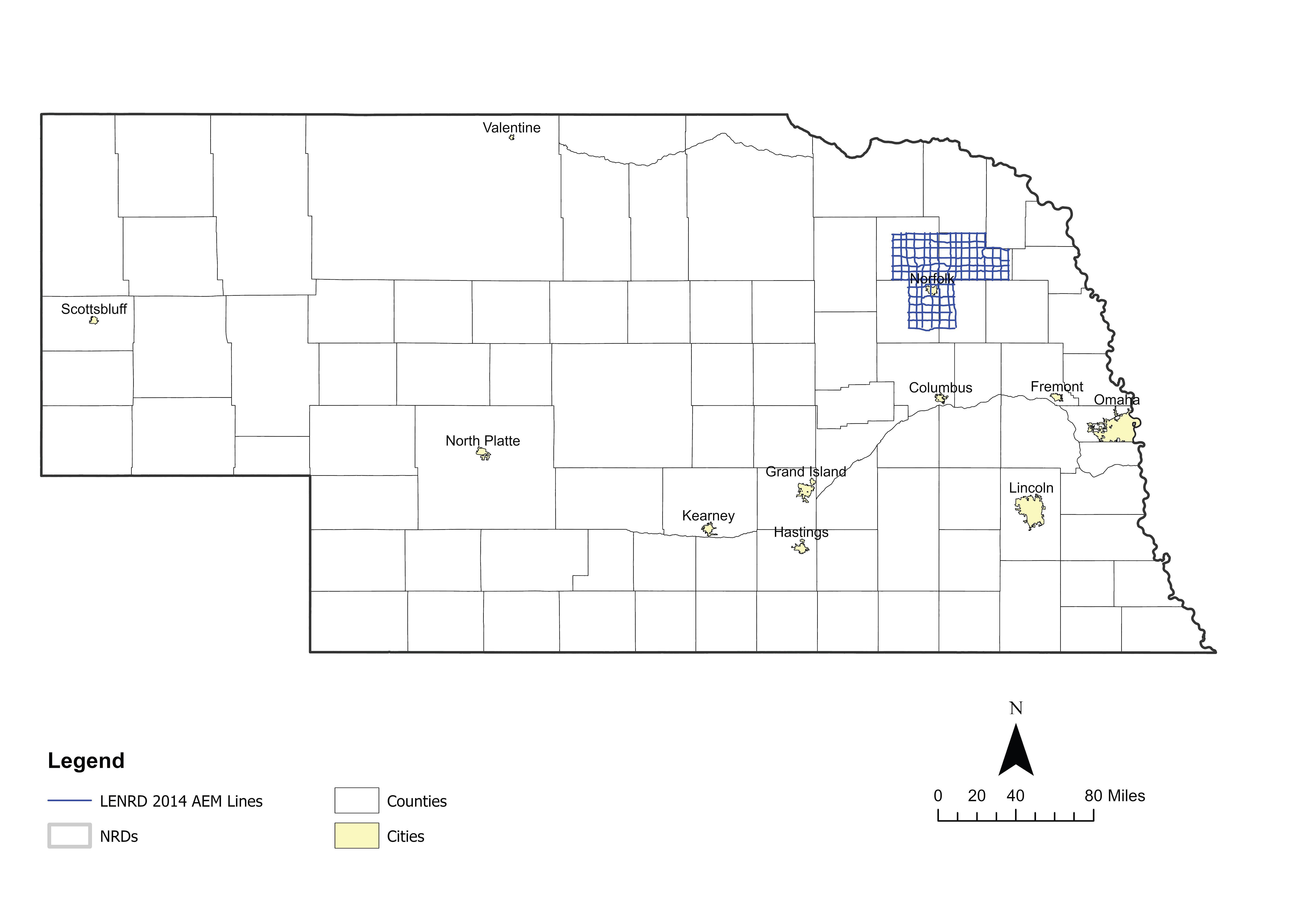 The Lower Elkhorn NRD conducted a 3-mile by 3-mile grid survey in October 2014 under the same mobilization as ENWRA's reconnaissance flights with the SkyTEM508 system. The survey and reporting methods were tailored to the District's groundwater management goals and provided visualizations below ground down to the bottom of the secondary bedrock aquifers. The report demonstrated key findings and results backed by previous scientific work and correlations with surrounding borehole information.
 2014 LENRD Airborne Electromagnetic Survey (AEM)
Airborne Electromagnetic Geophysical Surveys and Hydrogeologic Framework Development for Selected Sites in the Lower Elkhorn Natural Resources District, Northeastern Nebraska
Report Text (PDF, 24.8 MB)
Appendix 1 - AEM Resistivity and Interpretative Profiles (PDF, 29.6 MB)
Appendix 2 - Comparison between AEM and Historic CSD Cross Sections (PDF, 11.4 MB)
Appendix 3 - Depth of Investigation (PDF, 3.4 MB)
Appendix 4 - Data Deliverables (varies, 1.8 GB)
Google Earth Datasets:
The interpreted results for the 2014 AEM flights have been provided in Google Earth format. You can download the free version of Google Earth Pro by clicking here. Click here for a link to download the Google Earth datasets (.kmz files - repaired April 2019) from ENWRA's Dropbox (you can select "no thanks" to the sign-up for a Dropbox account and still download the files, download button can be hard to find). You must have Google Earth installed on your computer before downloading or opening the .kmz Google Earth dataset files.
If you already have a Dropbox account, please choose direct download to your computer so you do not fill up space on your personal Dropbox.
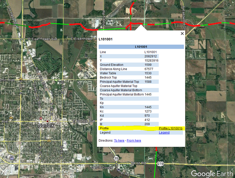
Please follow the instructions in the "read_me.txt" text file on Dropbox here AND save the downloaded files with the same exact file structure as shown on the Dropbox. Google Earth will look here on your hard drive: C:\LENRD_2014\Profiles\ for every profile image when you touch a link on a data dot - see example image below). All files must be unzipped in order to work in Google Earth.
Google Earth Tips and Tricks: Grab the map with your cursor and hold down the "u" key on your keyboard to view the earth looking straight down instead of at an angle. Do the same and hit the "n" key to orient the map north as up. Google Earth Pro (link above) is free and you can hit the file menu, then hit open, and then select all data import formats from the dropdown and open an ESRI shapefile or many other GIS file types in Google Earth directly from a saved location on your computer.