2006 to 2009 ENWRA Projects and Reports
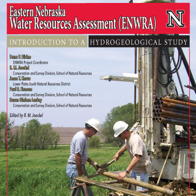
ENWRA - Introduction to a Hydrogeological Study
This publication contains detailed information about ENWRA's projects and goals, as well as a general overview of groundwater in eastern Nebraska.
USGS Open File Report 2008-1018
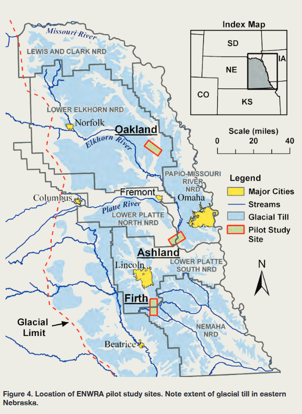
 USGS Open File Report 2008-1018. This report assesses multiple geophysical techniques that were applied near Oakland, Ashland and Firth, Nebraska.
USGS Scientific Investigations Report 2011-5228
 USGS Scientific Investigations Report 2011-5228. This report assesses multiple geophysical techniques that were applied near Oakland, Nebraska.
Ashland-area Helicopter Electromagnetic (HEM) Survey Report, 2006
 Ashland-area Helicopter Electromagnetic (HEM) Survey Report, 2006. This report contains maps and discussion of the hydrogeology in the Ashland, Nebraska area based on interpretation of HEM data collected in 2006.
Firth-area Helicopter Electromagnetic (HEM) Survey Report, 2007
 Firth-area Helicopter Electromagnetic (HEM) Survey Report, 2007. This report contains maps and discussion of the hydrogeology in the Firth, Nebraska area based on interpretation of HEM data collected in 2007.
Swedeburg-area Helicopter Electromagnetic (HEM) Survey Report, 2009
 Swedeburg-area Helicopter Electromagnetic (HEM) Survey Report, 2009. This report contains maps and discussion of the hydrogeology in the Swedeburg, Nebraska area based on interpretation of HEM data collected in 2009.
Sprague-area Helicopter Electromagnetic (HEM) Survey Report, 2009
 Sprague-area Helicopter Electromagnetic (HEM) Survey Report, 2009. This report contains maps and discussion of the hydrogeology in the Sprague, Nebraska area based on interpretation of HEM data collected in 2009.
USGS Open File Report 2010-1288
 USGS Open File Report 2010-1288. This report contains data gathered from HEM surveys flown in the Sprague and Swedeburg areas in the spring of 2009.
2009 HEM Poster
Preliminary Results from Helicopter Electromagnetic Surveys Over a Paleovalley Aquifer in Eastern Nebraska. This poster summarizes some of the HEM data collected in 2009. The poster was presented at the 2009 Geological Society of America Annual Meeting in Portland, OR.
2006 to 2009 Videos and 3D views
 Water Vision - Mapping Eastern Nebraska Aquifers with the Heliborne Electromagnetic Survey
Ashland Pilot Site 2006.
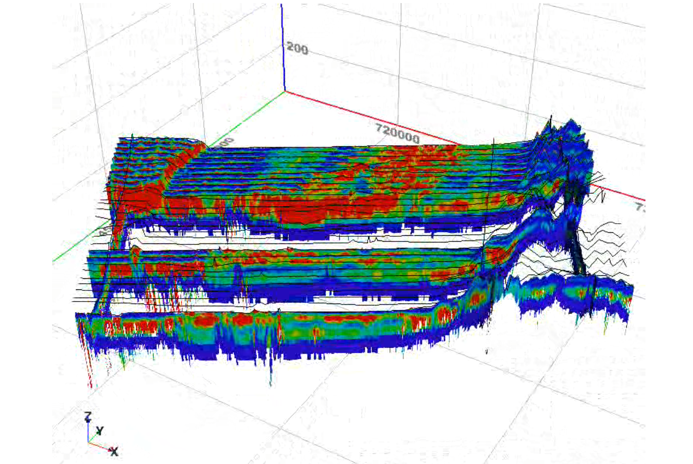
This video shows inverted HEM data from the Ashland pilot study site. The white areas are where data has been removed to provide a cross-sectional view. The starting viewpoint is to the north. The Todd Valley is represented by red in the upper left hand corner and the glacial till uplands near Gretna by blue in the upper right hand corner.
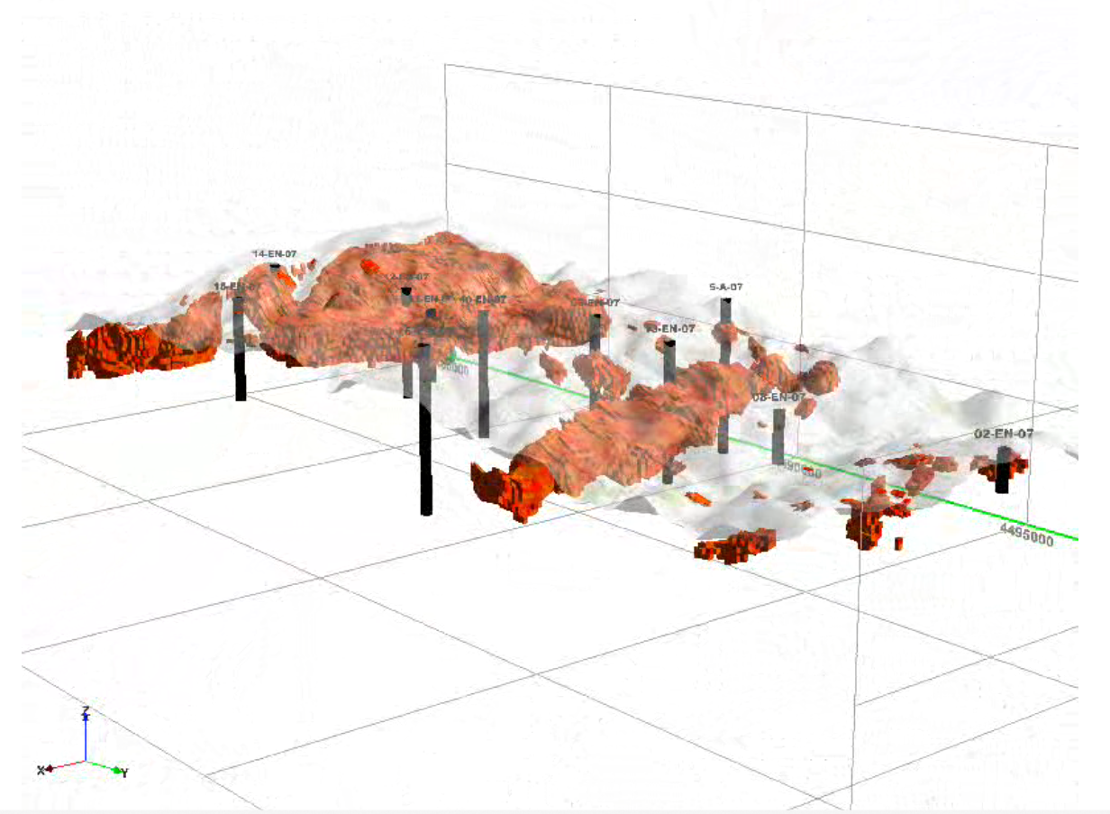
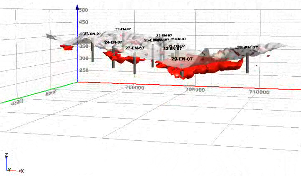
Firth Pilot Site 2007. This video shows the Firth voxel model generated from inverted HEM data. Red zones are areas having resistivity values greater than or equal to 80 ohm-meters. The semi-transparent layer represents ground surface, and the black columns represent test holes. The starting viewpoint is to the northwest. The two red areas likely correspond to the edges of a paleovalley aquifer.
Oakland Pilot Site 2007. This video the Oakland voxel model generated from inverted HEM data. Red zones are areas having resistivity values greater than or equal to 80 ohm-meters. The semi-transparent layer represents ground surface, and the black columns represent test holes. The starting viewpoint is to the north. The red swath coincides with sand and gravels associated with Logan Creek.