2014/2015 ENWRA Reconnaissance Surveys

ENWRA's Reconnaissance AEM Survey effort was broken into two phases: approximately 750 line-miles in the north part of eastern Nebraska flown in October 2014 and 550 line-miles in the south part flown in April 2015. Interpretation of the approximately 1,300 line-miles of AEM data collected in 2014/2015 with the SkyTEM508 system provided a subsurface characterization of the various geologic materials that correlated with pre-existing geologic information. The AEM provided detailed verification and quantification of the geology that underlies the project area. The interpretation also provided a new understanding of the glacial and bedrock features present in the subsurface.

Lithologic descriptions from test holes and other supporting down-hole geologic and geophysical information from the University of Nebraska Conservation and Survey Division(CSD) provided the most useful historical information in the development of the new hydrogeologic framework.

2020 Airborne Electromagnetic (AEM) Surveys

The Nemaha NRD, Papio-Missouri River NRD and Middle Republican NRD conducted AEM flights utilizing the SkyTEM304M system in summer 2020 with Water Sustainability Fund (WSF) grant dollars awarded in November 2019. AEM flight lines were also conducted in 2020 in Cass Co. Nebraska.

2016 Airborne Electromagnetic (AEM) Surveys

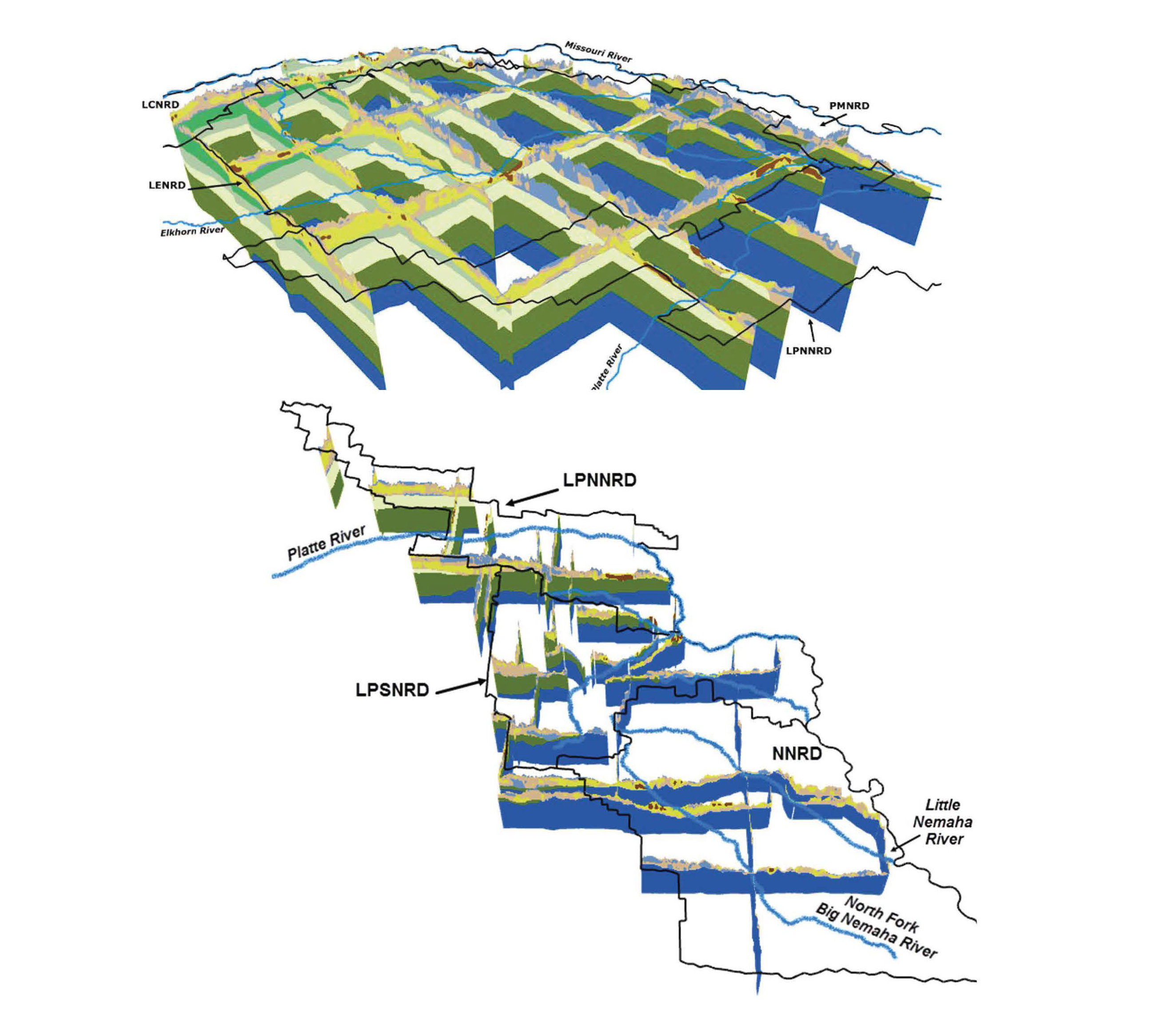
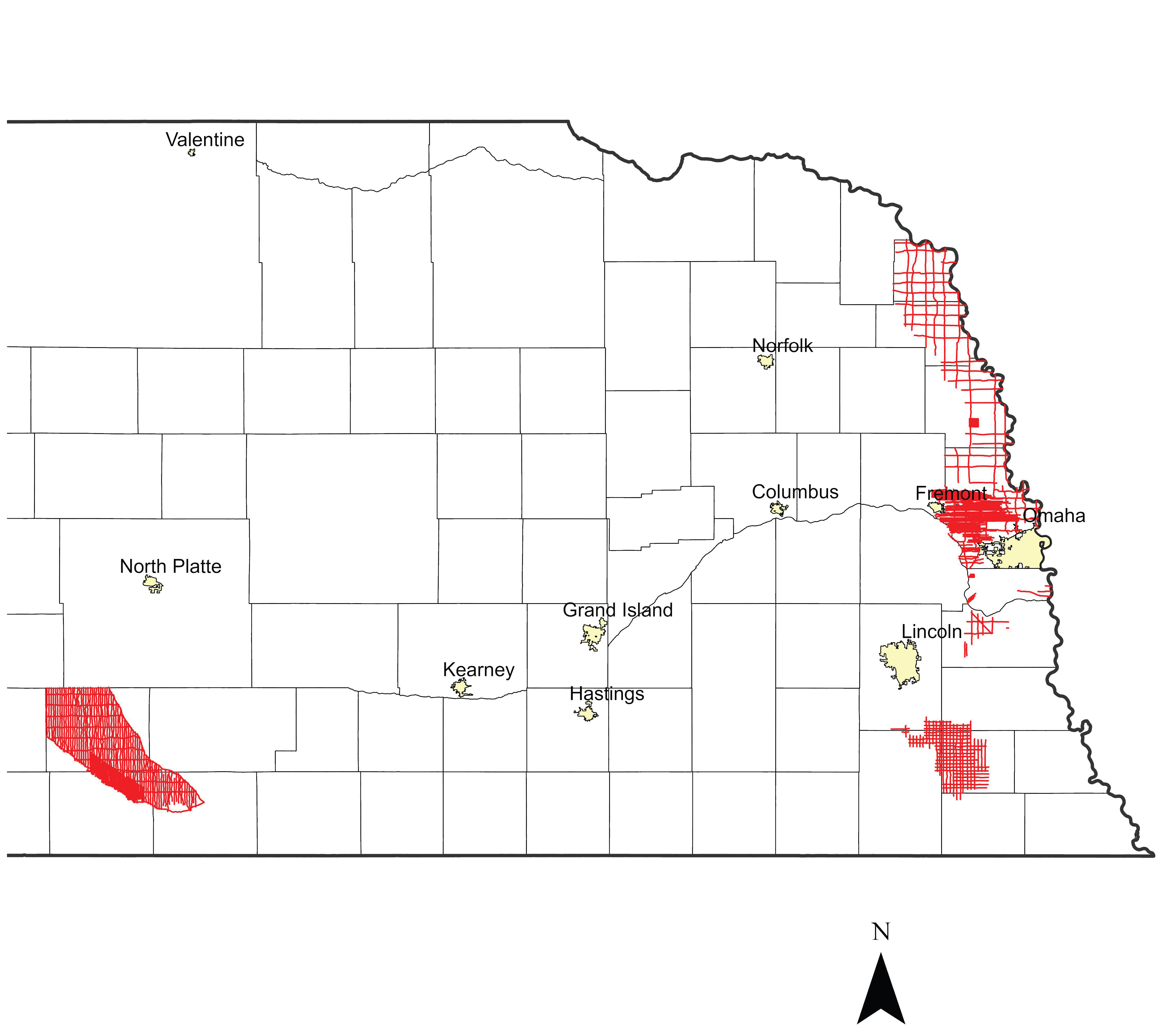
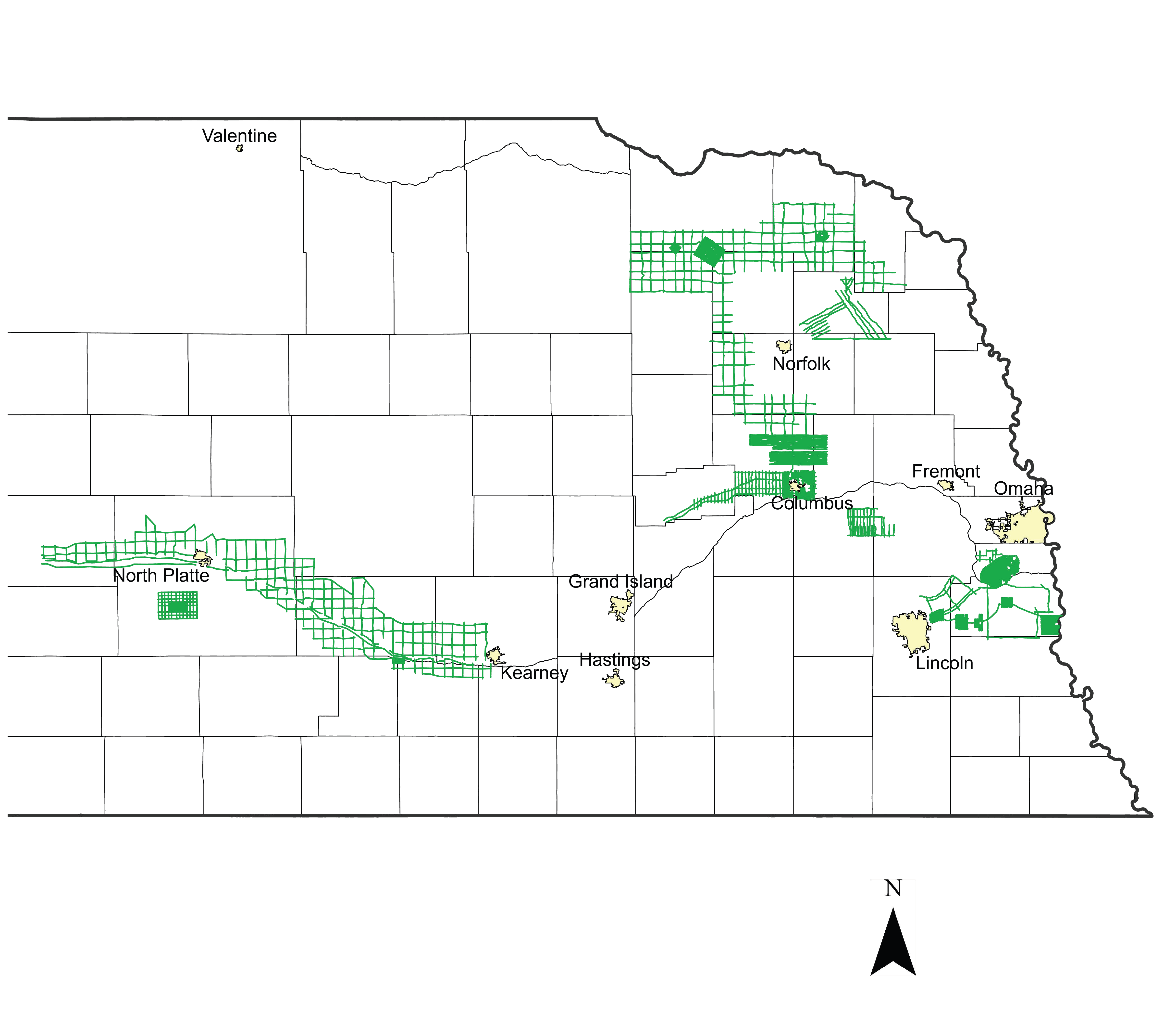
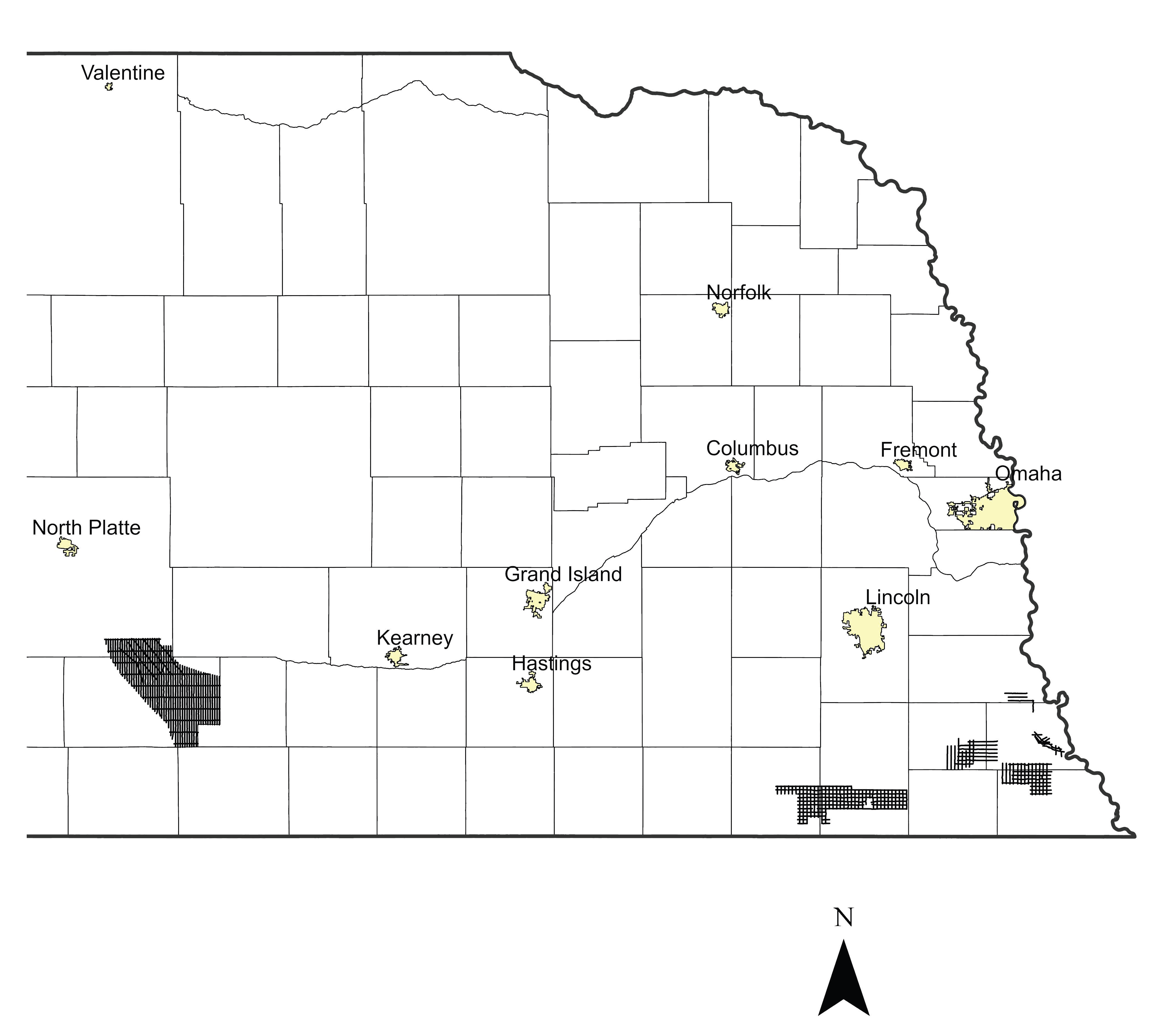
Several Natural Resources Districts (NRDs) across the state conducted AEM flights in July and early August 2016 using Water Sustainability Fund (WSF) grant dollars awarded in April 2016: Lewis and Clark NRD, Lower Elkhorn NRD, Papio-Missouri River NRD, Lower Platte North NRD, Lower Platte South NRD, Central Platte NRD, Twin Platte NRD, Lower Loup NRD & the BAZILE AREA (Lewis and Clark, Lower Elkhorn, Upper Elkhorn, Lower Niobrara NRDs). Each NRD had a mix of the following types of surveys flown: block flights (tightly spaced flight lines for determining aquifer boundaries and/or potential groundwater volumes), transect/tie line flights (longer reconnaissance type flight lines), and grid flights (hybrid of reconnaissance and detailed type surveys, aquifer boundary mapping).

2023 Airborne Electromagnetic (AEM) Surveys

Several 2023 AEM surveys were flown by the Nebraska NRDs in the summer of 2023. The Nemaha NRD and neighboring Lower Big Blue NRD were awarded Water Sustainability Fund (WSF) grant dollars for the upcoming 2023 surveys as well as the Middle Republican NRD. The resulting datasets from each of the NRD surveys will be uploaded to the Nebraska GeoCloud (NGC): https://snr.unl.edu/csd/geology/AEM.aspx. The NGC is a web-based digital platform for geophysical, geological, and groundwater data and models. The purpose of the NGC is to archive Nebraska’s vast volume of data and make it accessible to both model builders and model users.

2018 Airborne Electromagnetic (AEM) Surveys

Summary Report on “Airborne Electromagnetic Mapping and Hydrogeologic Framework of Selected Regions of the Eastern Nebraska Water Resources Assessment Area” Chapters Completed for Lewis and Clark, Lower Elkhorn, Lower Platte North, Lower Platte South, Nemaha, and Papio-Missouri River Natural Resources Districts. Jared D. Abraham, P.G., Theodore H. Asch, P.G., James Cannia, P.G. and Tammi L. Renninger, Elephant Fish, LLC