Lower Big Blue NRD 2023 AEM Survey
Documents
Links
Datasets
Google Earth Datasets:
The interpreted results for the 2023 AEM flights have been provided in Google Earth format. You can download the free version of Google Earth Pro by clicking here.
*Click here for a link to download the Google Earth datasets from ENWRA's Dropbox.
The link above provides a link to the KMZ Folder deliverable with ".kmz" files that will show the 2023 AEM flight line locations: "as flown" and "retained" where data was chopped out from interferences (Flight Lines Folder), coarse materials in the top 6.6 feet (Recharge Targets Folder), as well as interpreted ".kmz" files that show clickable data dots in Google Earth (LBBNRD23_Profiles Folder) for the Lower Big Blue NRD: LBBNRD23_SCI02_Interp_KMZ.kmz. There are 61 associated image files (22 MB) linked to the data dots provided in the interpreted .kmz file.
You do not have to sign-up for a Dropbox account to download the files (sometimes written in fine print at the bottom of a log in or sign up button or depicted as a down arrow symbol). You must have Google Earth installed on your computer before opening the .kmz Google Earth dataset files. If you already have a Dropbox account, please sign out before clicking this link and choose download so you do not fill up space on your personal Dropbox.
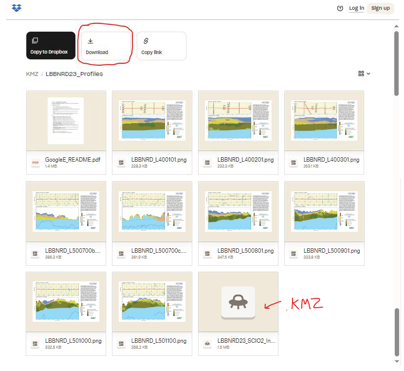
Please follow the instructions in the "GoogleE_README.pdf" PDF file on Dropbox here and save the downloaded files with the same exact file structure as shown on the Dropbox onto your computer's C drive. See the video tutorial example here for detailed walkthrough. Google Earth will look here on your hard drive: C:\LBBNRD23_Profiles for every profile image when you touch a link on a data dot - see example image below.
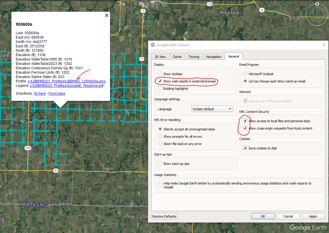
NOTE: You can view flight lines from some mobile devices if you have Google Earth but you need to use a Microsoft Windows computer to see the data and hot linked profile images. It is recommended to zoom into a road intersection first so the larger .kmz files don't take too long to load on-screen.