Lower Platte South NRD 2016 AEM Survey
Documents
Links
Datasets
Google Earth Datasets:
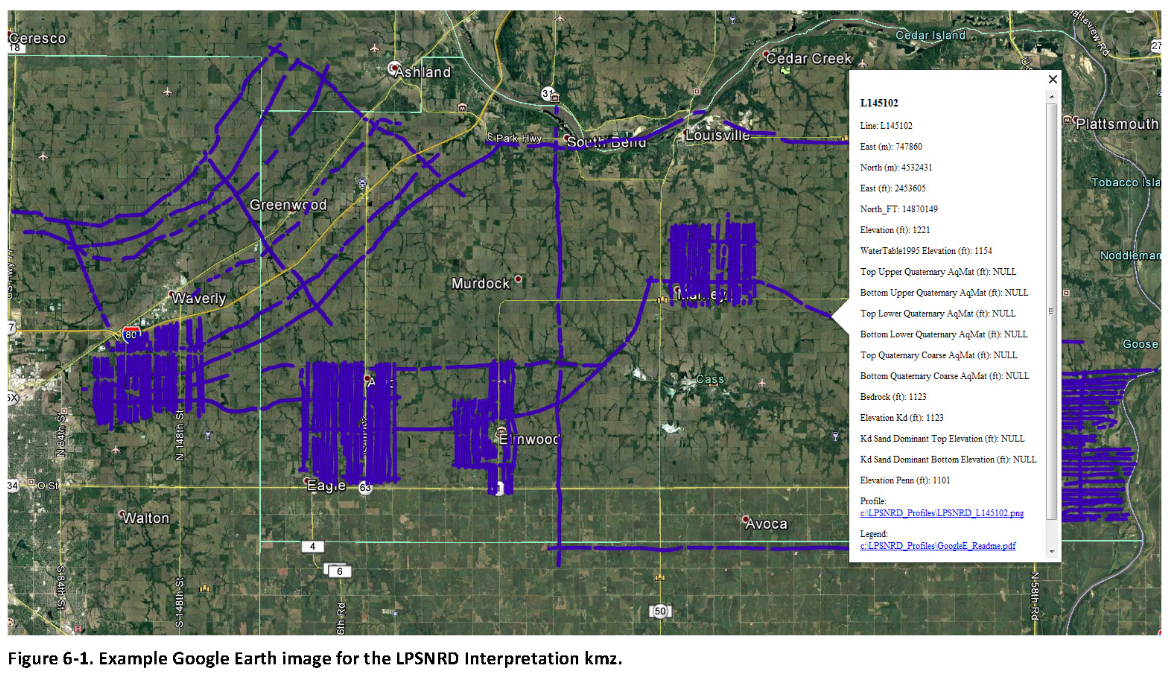
The interpreted results for the 2016 AEM flights have been provided in Google Earth format. You can download the free version of Google Earth Pro by clicking here.
Click here for a link to download the LPSNRD Google Earth datasets (207 MB: one ".kmz" file and 164 images) from ENWRA's Dropbox.
You do not need to sign-up for a Dropbox account to download the files (button can be hard to spot, if you already have a Dropbox account please logout and choose download so you do not fill up space on your personal Dropbox). You must have Google Earth installed on your computer before downloading or opening the .kmz Google Earth dataset files.
Please follow the instructions in the GoogleE_README.pdf legend file on Dropbox here AND save the downloaded files with the same exact file structure as shown on the Dropbox. Google Earth will look here on your hard drive: C:\LPSNRD_Profiles\ for every profile image when you touch a link on a data dot in Google Earth - see example image below. The files on your C drive must all be unzipped in order to work from Google Earth. For example: you can create a folder called "LPSNRD_Profiles" directly on your C drive, unzip the files wherever your browser typically saves downloaded files, and then save the unzipped downloaded files to that "LPSNRD_Profiles" folder on your C.
Google Earth Tips and Tricks: Grab the map with your cursor and hold down the "u" key on your keyboard to view the earth looking straight down instead of at an angle. Do the same and hit the "n" key to orient the map north as up. Google Earth Pro (link above) is free and you can hit the file menu, then hit open, and then select all data import formats from the dropdown and open an ESRI shapefile or many other GIS file types in Google Earth directly from a saved location on your computer.