Lower Elkhorn NRD Clarkson-Howells 2013 AEM Survey
Documents
Datasets
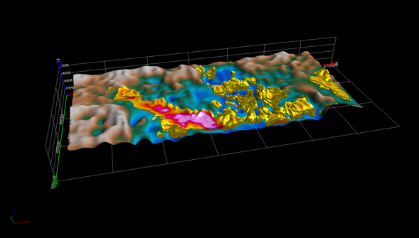
Report on AEM flights conducted for the area between the towns of Clarkson and Howells that experienced record groundwater declines during 2012. Exploration Resources International (XRI) entered into an agreement with Lower Elkhorn to undertake the hydrogeologic study in 2013.
The results presented in the Clarkson-Howells Report have been provided in Google Earth format. You can download the free version of Google Earth Pro by clicking here. Once you have Google Earth installed on your computer you can download the .kmz file (656 KB) from the ENWRA Dropbox here. Dropbox is free for users. You do not need to sign-up for a Dropbox account to download the files (can be hard to find the download button). If you already have a Dropbox account, please save to your computer hard drive (choose download) so as to not fill up space on your personal Dropbox account.