Lower Big Blue NRD 2024 AEM Survey
Documents
Links
Datasets
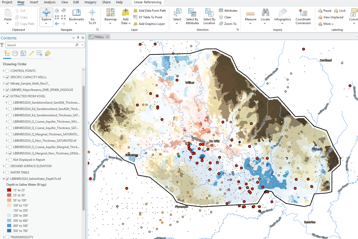
ESRI Datasets:
Google Earth Datasets:
The interpreted results for the 2024 AEM flights have been provided in Google Earth format. You can download the free version of Google Earth Pro by clicking here.
*Click here for a link to download the Google Earth datasets from ENWRA's Dropbox.
The link above provides a link to the KMZ Folder deliverable with ".kmz" files that will show the 2024 AEM flight line locations: "as flown" and "retained" where data was chopped out from interferences (Flight Lines Folder), as well as interpreted ".kmz" files that show clickable data dots in Google Earth (LBBNRD24_Profiles Folder) for the Lower Big Blue NRD: LBBNRD2024_Interpretation_KMZ.kmz. There are 60 associated image files (117 MB) linked to the data dots provided in the interpreted .kmz file.
You do not have to sign-up for a Dropbox account to download the files (sometimes written in fine print at the bottom of a log in or sign up button or depicted as a down arrow symbol). You must have Google Earth installed on your computer before opening the .kmz Google Earth dataset files. If you already have a Dropbox account, please sign out before clicking this link and choose download so you do not fill up space on your personal Dropbox.
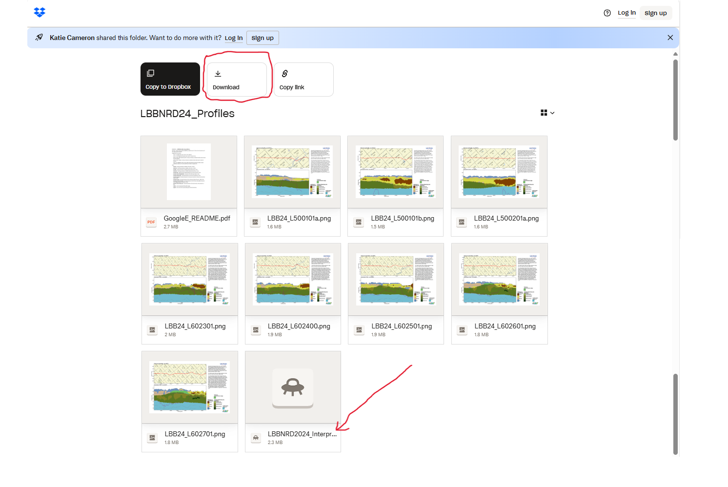
Please follow the instructions in the "GoogleE_README.pdf" PDF file on Dropbox here and save the downloaded files with the same exact file structure as shown on the Dropbox onto your computer's C drive. See the video tutorial example here for detailed walkthrough. Google Earth will look here on your hard drive: C:\LBBNRD24_Profiles for every profile image when you touch a link on a data dot - see example image below.
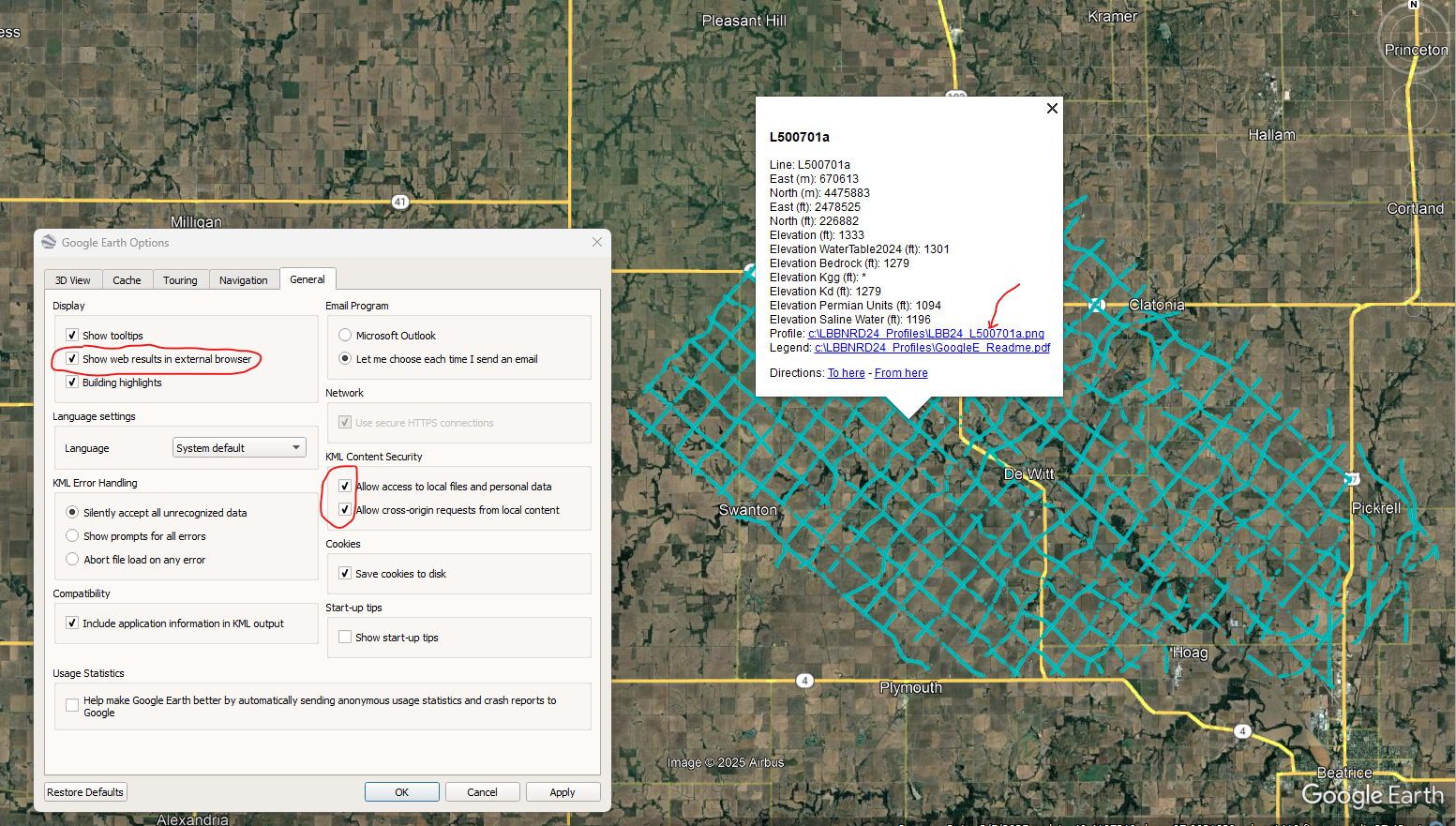
NOTE: You can view flight lines from some mobile devices if you have Google Earth but you need to use a Microsoft Windows computer to see the data and hot linked profile images. It is recommended to zoom into a road intersection first so the larger .kmz files don't take too long to load on-screen.